09.2020 UAV positioning
Successful radio tests on public mobile network
The positioning of unmanned aerial vehicles (UAVs) also works successfully on public mobile network (PLMN) - as evidenced by the radio tests conducted by HungaroControl and Magyar Telekom experts at the end of July in downtown Budapest. Leading-edge technology could not only be another breakthrough in locating drones, but could even help identify and segregate small-scale traffic players in the future.
For the first time in 2018, HungaroControl achieved significant results in locating unmanned aircraft:
Our experts proved during the test flights conducted at Budapest Liszt Ferenc International Airport together with Nokia that in addition to GPS-based tracking, it is also possible to position drones based on a mobile telecommunication network. This has been a huge step forward because the use of this technology is safer than satellite navigation - the latter signals can be disturbed by anyone with active blockers, and the GPS system does not transmit an error message about itself if it does not work properly. Our company has put the idea into practice using the fourth generation wireless (4G) data transmission standard, LTE (Long Term Evolution), which can collect data and communicate with codes from several - up to 74 - mobile phone cells in parallel, which is why it is difficult to interfere.
OTDOA-based (Observed Time Difference of Arrival) positioning is based on reference signal time difference (RSTD) measurements, the basic condition of which is network synchronization. During the measurements, the user equipment (UE) determines the relative time difference between the server and a neighboring cell. Based on this difference, a hyperbola can be determined that gives the possible locations of the mobile. However, more accurate positioning requires the measurement of additional neighbors and the determination of hyperbolas. As a result, the intersection of the output hyperbolas determines the area in which the measured device, in this case the unmanned aircraft, is located. The experience is that 3 hyperboles from 3 measurements already provide sufficient accuracy. These three measurements, of course, require three OTDOA-capable cells, which are measured in pairs, respectively.
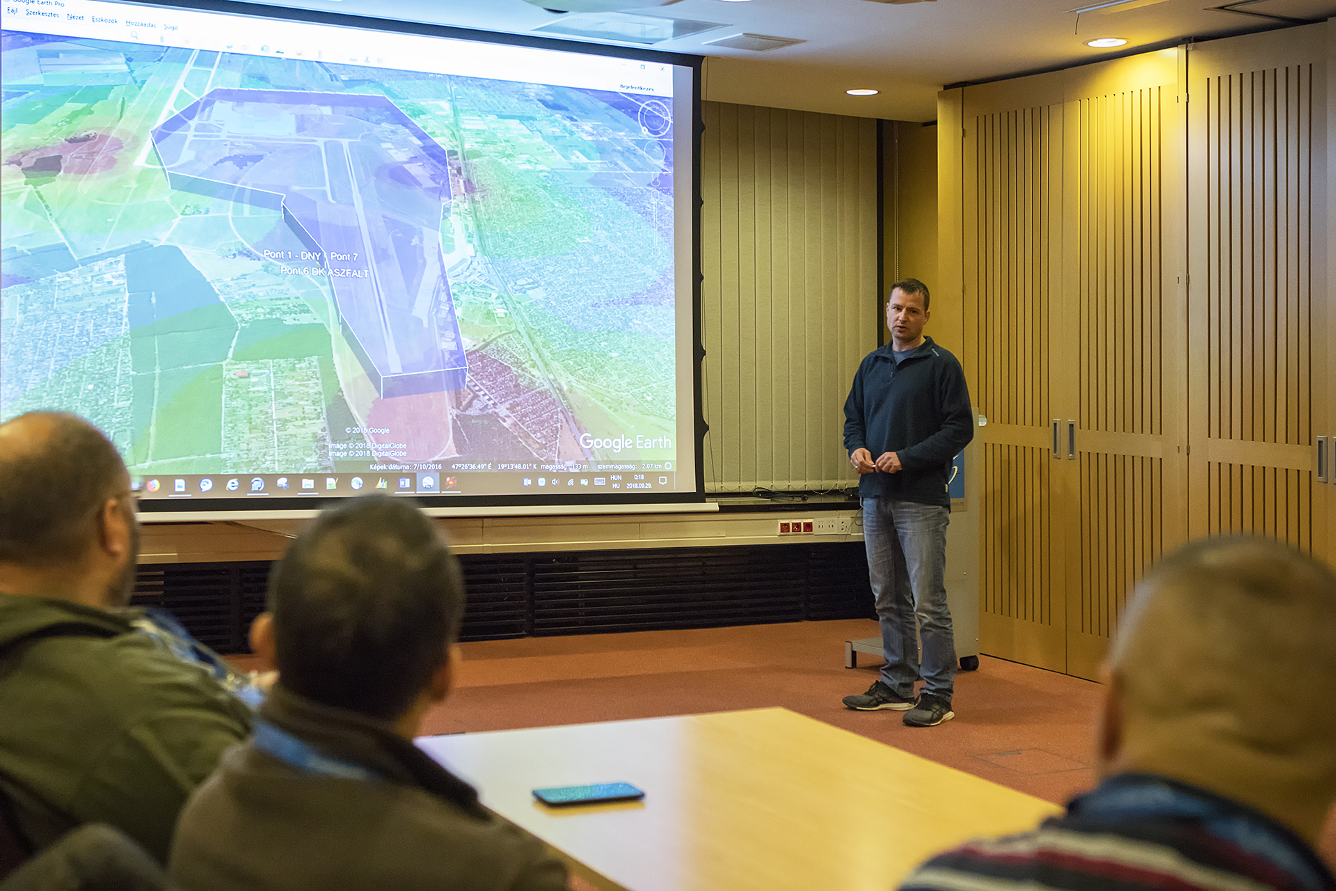
“Encouraged by the success of the airport experiment two years ago, the project, launched by our company to explore the possibility that public mobile networks, used by the majority of people on a daily basis, may be suitable for a similar drone principle may have entered a higher maturity phase.
At the end of several months of preparations and consultations, we selected two locations, Zalaegerszeg and Budapest, to validate the concept. Of course, we required temporary airspace for the operations, which required the involvement of various government bodies due to the special nature of the tasks, and they maximally supported the implementation of the project, ”recalled Sándor Dobi, HungaroControl's research and development expert in the capital, which was also visited by Radar.
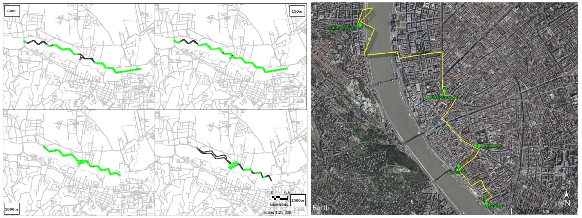
The first test flights were carried out in Zalaegerszeg in May this year - at altitudes of 60, 150, 1000 and 2500 meters, each 6 km long. “In the tests of the LTE project, we examined the radio conditions of the open mobile network at these altitudes,
that is, for example, how many cells are seen on mobile devices placed on the drone, we also looked at their signal, noise, and interference levels, and they also provided a framework for answering the question of whether we could make a mobile call at an altitude of 2,500 meters. Analyzing the aforementioned and several other parameters, we can conclude that the OTDOA function is available. I am pleased to say that these tests have already provided a number of interesting feedbacks. At the same time, we wanted to perform tests in a real metropolitan environment, so we selected the center of Budapest as the second location. Here we had to face extra factors, ie completely different types of challenges: due to the built-in, the design of the radio network and the nature of the interference are very different. Here, we also had the opportunity to examine whether WiFis in households or some surveillance cameras could interfere with communication between the UAV and the remote control device, as most of them use the 2.4 and 5.8 GHz frequencies as well. In some of the operations, we were also able to perform flight tests over the Danube, which, according to colleagues in the telecommunications expert, is also special in terms of measurement, ”explained a member of the research and development team.
In the center of Budapest, the measurements were performed on a pre-defined route of 5.8 km in length, but due to the congestion of the airspace and flight safety, at altitudes of 60, 150 and 300 meters compared to the tests in Zalaegerszeg. As in Zalaegerszeg, two measuring devices were mounted on the belly of the devices, with the help of which the possibility of positioning based on the 4G mobile network was studied at 800 and 1800 MHz, respectively. “There are several positioning approaches with different accuracy and technology requirements, and after considering several of these parameters, TCHI colleagues opted for OTDOA. Simplified, this positioning technique works on a very similar principle to the multilateration currently used at the airport, in fact, the transfer of this technology to mobile network infrastructure. During each flight, we tried to fly as long distances as possible, to spend as much time in the air as possible, so that we could get as much useful data as possible, which could help us make decisions that could form the basis of the next phase of the project, ”explained Sándor Dobi.
During both tests, the Samsung Galaxy S9 mobile phone provided by Magyar Telekom was mounted on the drones. One device, forcing LTE to 800 MHz and the other to LTE 1800 MHz, examined various parameters of the mobile network and collected data for subsequent analysis from which the expected availability of the OTDOA function could be estimated. Evaluating the results of the tests in Zalaegerszeg, the figure below shows in green, where OTDOA would have been available during the flights performed at each altitude. It can be seen that at 800 MHz approx. Up to 1000 meters, at 1800 MHz approx. Up to 150 meters, the conditions under which positioning would work would be met. Experts have also found that LTE mobile service can be expected up to 1000 meters on the 1800 MHz network and up to 2000-2500 meters on the 800 MHz network. The majority of LTE project participants are members of the CybAIr Cluster. The temporary airspace was provided by the project's initiator, HungaroControl, the 4G mobile network and mobile devices equipped with measurement software were provided by Magyar Telekom, professional advice by Plezintor at both locations, and the evaluation of the collected data and project management tasks are coordinated by CybAIr Cluster. “This project is important for the CybAIr Cluster and the Cluster itself was created to enable HungaroControl to create all aviation research and development projects that work with drones, the aerospace industry and related artificial intelligence-based technologies. Benedek Stolpa, Managing Director of CybAIr Cluster Nonprofit Ltd., emphasized.
In the tests in Zalaegerszeg, with the Rotors & Cams' own devices and in the capital with the drones 1 and 2 of the MPDrone DJI Inspire, the prescribed distances were performed in automatic mode at a predetermined constant speed with appropriate safety protocols. “It is especially important to us to have a system in place that allows drones to be tracked. This is because we work with these devices on a regular basis and in order to avoid accidents, we need to know if a hobby user, for example, is flying into our work area. The technology we are now testing would make it much easier for us to join a solution that provides this, as it is more cost-effective to install lightweight on-board mobile devices and SIM cards on our drones. In addition, visibility would encourage participants in the growing drone world to follow rules, ”said Attila Mészáros, MPDrone's managing director for the drones and their pilots at the Budapest site.
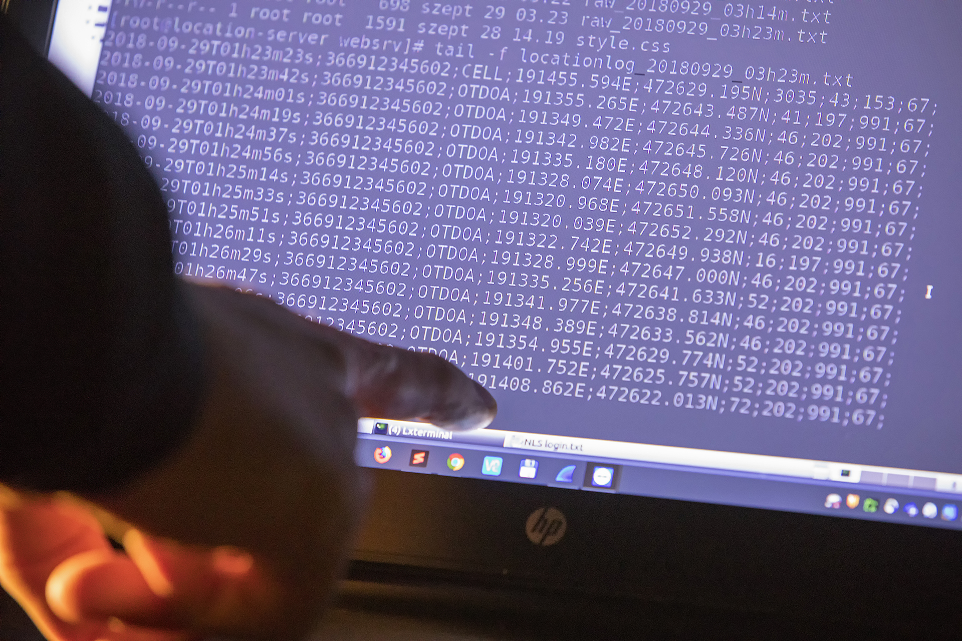
During processing, the information is displayed on a map based on the GPS coordinates of the drones: the quality of the mobile network coverage at different altitudes on the completed route is indicated in different colors. The evaluation of the data from Budapest flights is expected to be completed by the end of August. “Based on the experience of the tests in Zalaegerszeg, it seems that the technology may be suitable for locating cooperating unmanned aircraft, subject to certain restrictions. However, this will require further network enhancements in the future, such as installing a Location Base Server that performs positioning calculations, network synchronization, and turning on and testing the OTDOA capability to be able to actually position. Others are already looking at mobile technology, but they basically want to use it to transmit GPS position and other data from drones - which we used for positioning in last year's USIS project anyway - while our solution would use the mobile network itself for positioning, independent of GPS. from, ”Sándor Dobi pointed out.
The implementation of the positioning of drones also plays an important role in the development of the so-called UTM system for their traffic management and in the integration of unmanned aerial vehicles into safe airspace, to which HungaroControl pays special attention. However, cutting-edge technology could represent another breakthrough not only in the location of drones, but also in the handling of small aircraft traffic - such as the identification and segregation of small aircraft, gliders and paragliders.
“With the solution initiated by György Blazsovszky, an employee of HungaroControl, we can raise aviation safety to a new level in the entire world of small aircraft in the future. With this technology, we will be able to position and segregate an increasing number of operators in the lower airspace, including unmanned aerial vehicles, of course, in the future, offering an affordable and much higher-capacity alternative, ”he said. Out of closing Sándor Dobi.
04.06.2020
COMMISSION IMPLEMENTING REGULATION (EU) 2020/746
amending Implementing Regulation (EU) 2019/947 as regards postponing dates of application of certain measures in the context of the COVID-19 pandemic.
‘It shall apply from 31 December 2020.’;
05.2020.
Mydronespace - test version intro
30.09.2019
This is how the Mydronespace application works
11.06.2019 Information on EU legislation on unmanned aerial vehicles
Today, both regulations on unmanned aerial vehicles have been published in the Official Journal of the European Union No 152. These are the following:
- Commission Delegated Regulation (EU) 2019/945 on Unmanned Aircraft Systems and third-country aircraft operators (formerly referred to as the Delegated Regulation)
- Commission Implementing Regulation (EU) 2019/947 on rules and procedures for unmanned aerial vehicle operations (regulation referred to earlier as Implementing Regulation)
Both regulations will enter into force on the twentieth day after its publication, ie 1 July 2019.
The provisions of Commission Implementing Regulation 2019/947 will apply from 1 July 2020, with the remaining period of application of certain provisions as previously indicated.
27.05.2017 EASA Flying a civil drone (Unmanned aircraft)
A European Aviation Safety Agency animation introducing the concept of operations in relation to the use of civil drones also referred to as Remotely Piloted Aircraft Systems – RPAS. EASA is working in providing a new set of rules for operating civil drones which are proportionate and risk based.
More information
http://easa.europa.eu/drones
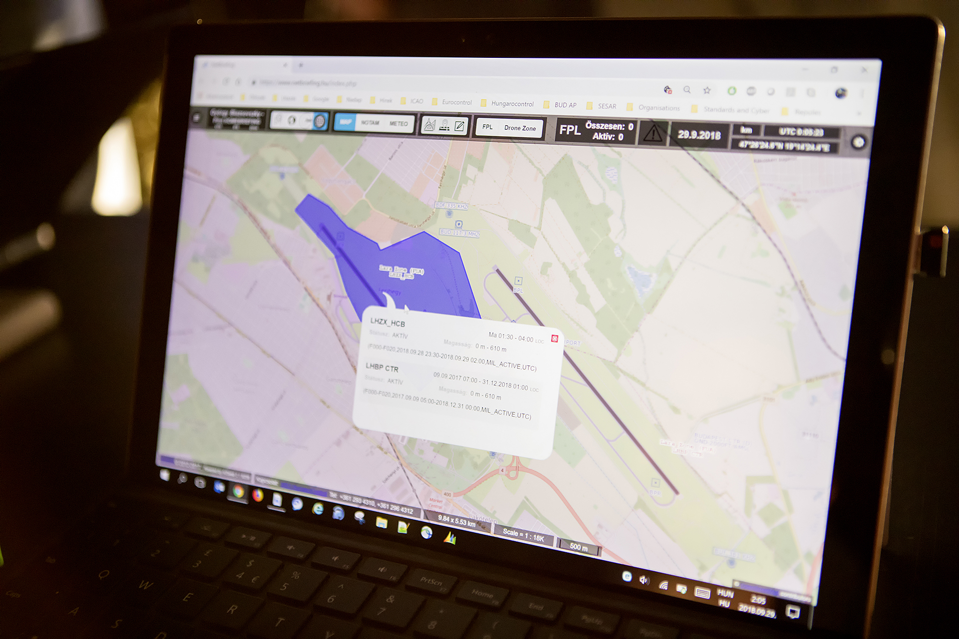
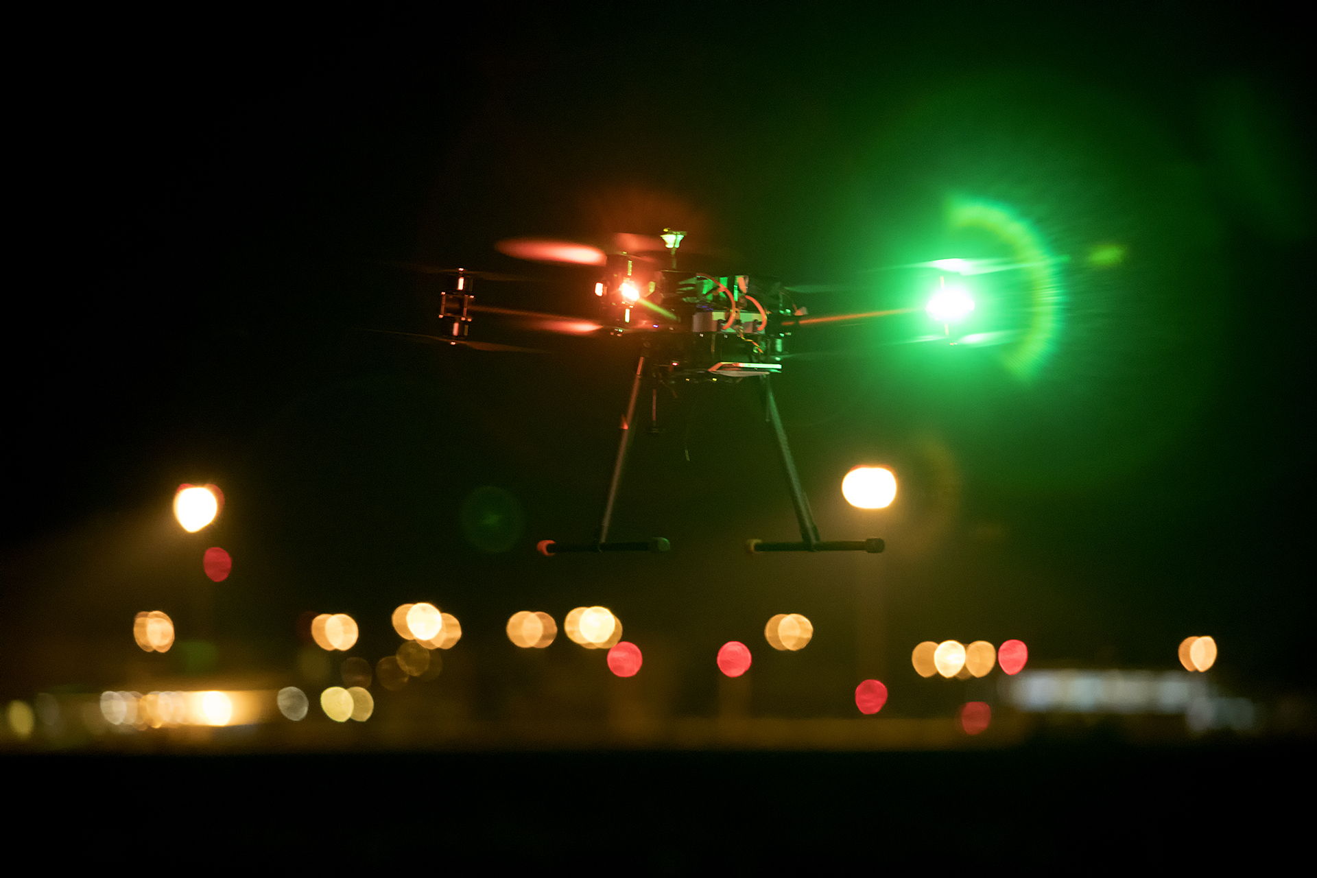
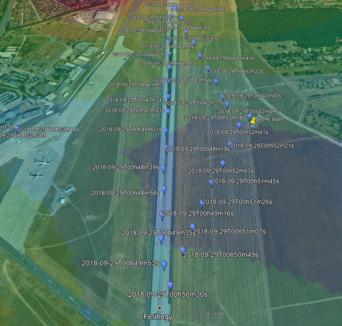
On September 29, 2018, an unmanned aircraft was flying at Budapest Liszt Ferenc International Airport
Breakthrough in unmanned aerial vehicle positioning
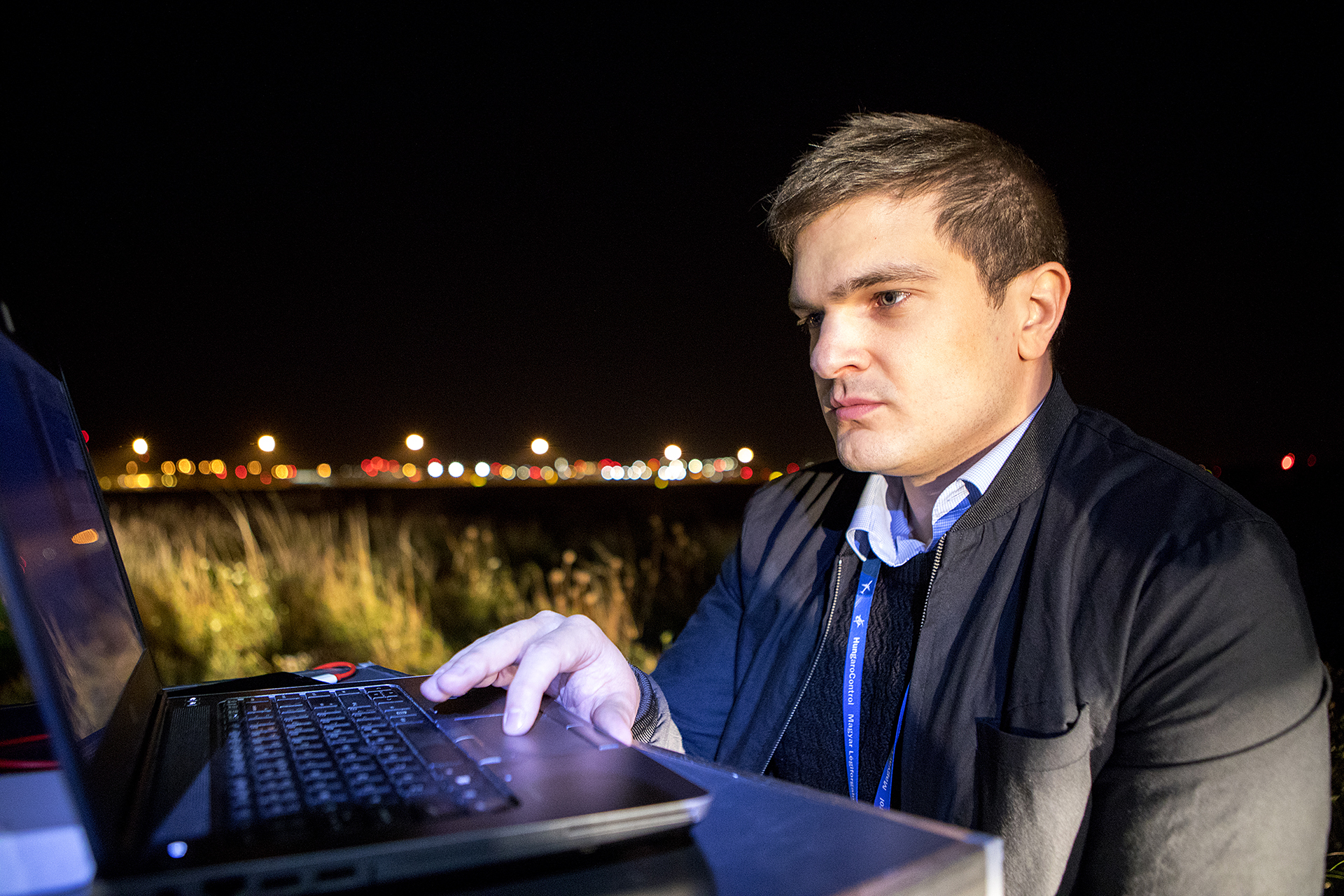
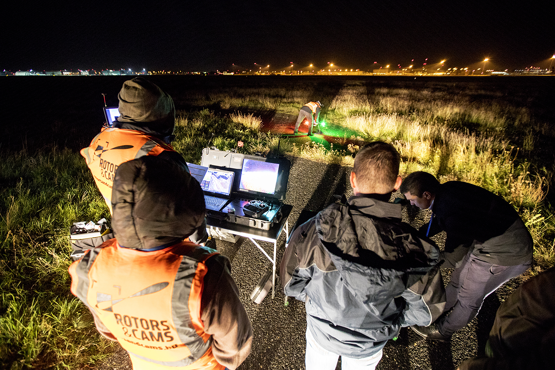
We can say without exaggeration that Budapest Liszt Ferenc International Airport was the world premiere on the last weekend of September 2018. The experts of HungaroControl, headed by György Blazsovszky, telecommunication system development engineer, have proved that instead of GPS-based positioning of unmanned aerial vehicles it is possible - more secure - to have their mobile tracking. Until now, technology secrecy was in place with all partners involved in securing technology.
Thanks to Budapest Liszt Ferenc International Airport, Nokia, National Media and Communications Authority, Ministry of Defence, Rotors and Cams and HungaroControl for supporting the test.
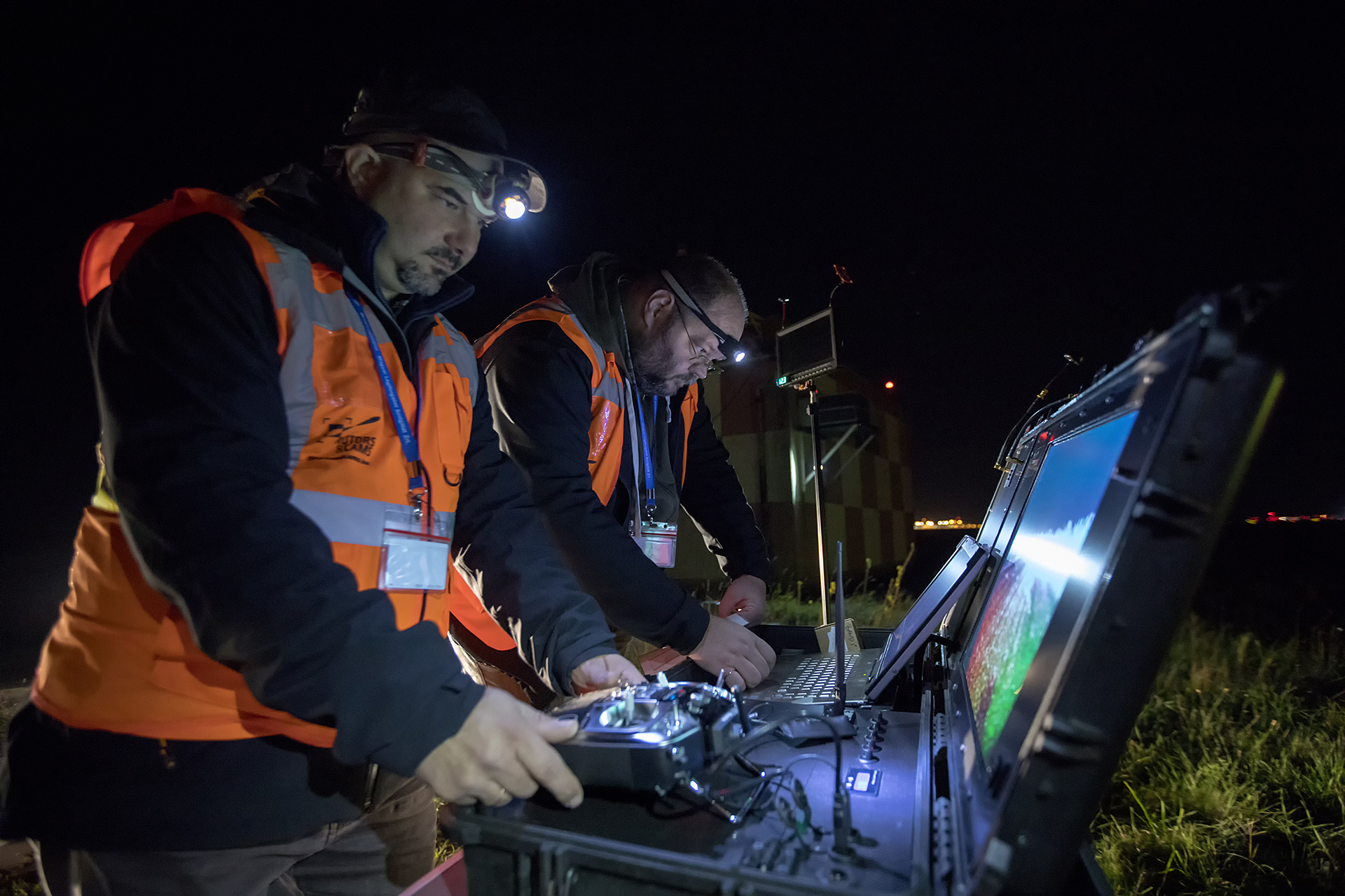
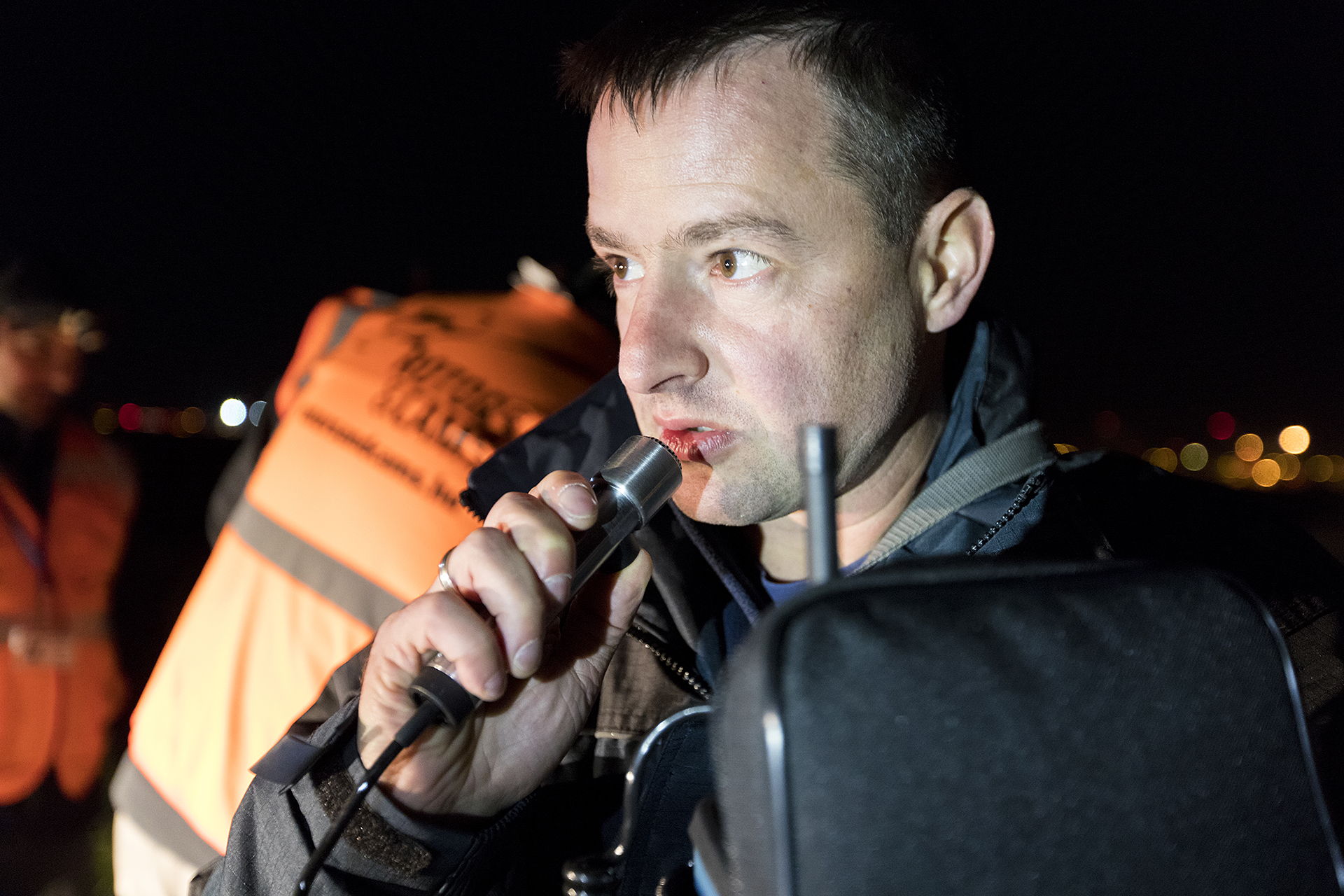
The experiment has progressed in several ways, as it has already been challenging to issue a license to use the temporary airspace needed for testing at an operating airport. The mastermind, György Blazsovszky, told Radar that they had not previously been convinced that, in such a "radio interference" environment, unmanned aircraft would be able to fly at all. The Liszt Ferenc International Airport can also be considered an exciting location as the total number of impulses generated by radars and other devices in this area are of the order of megawatt, while unmanned aircraft respond to microwatts. When selecting a location, special care was taken to ensure that the experiment was conducted in a radio-interrupted environment. Testing has clearly shown that these conditions do not affect the control of remote control devices.
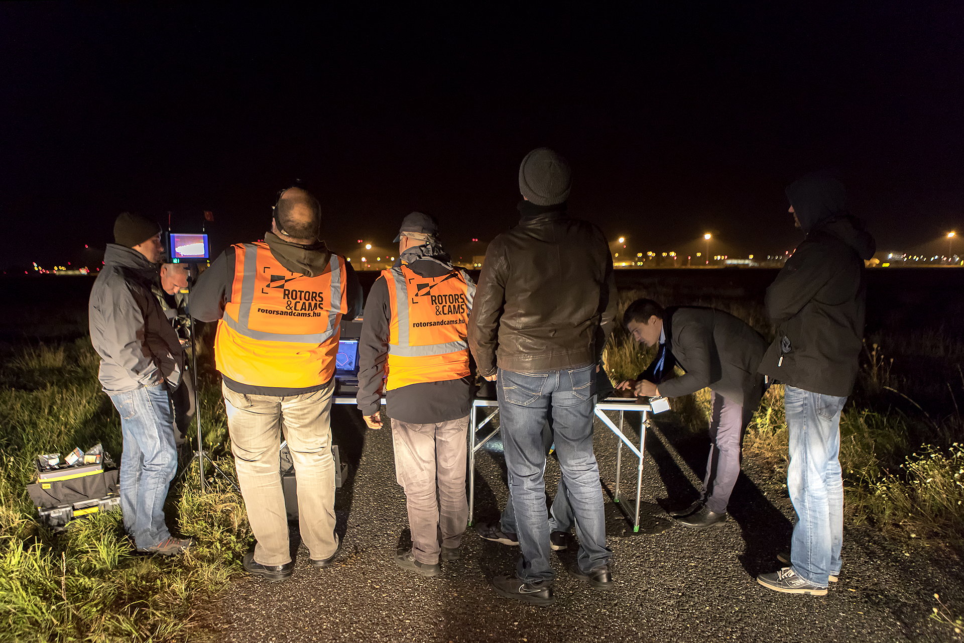
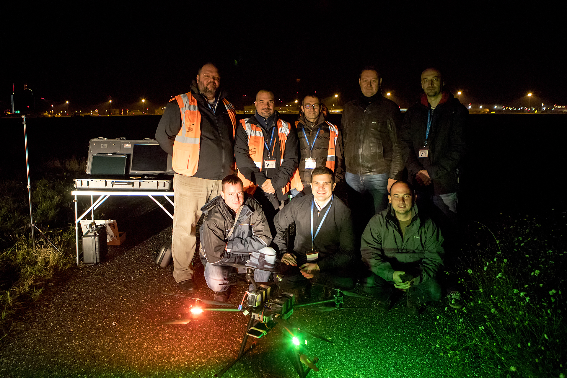
The time factor also did not favour the experiment: until mid-October, Nokia had to return the radio module that was used in the Budapest experiment, and the temporary airspace and frequency license were given for thirty days. György Blazsovszky has been involved in the implementation of the project and the related organizational tasks since May. “We actually had zero infrastructure, so thank you very much to Budapest Airport for the action and the media authority to provide free frequency. The excitement came out, and it was doubtful whether the test equipment would arrive in time, whether the software would be ready, and whether the owner BUD AP, the air traffic service provider HungaroControl and the Ministry of Defence would approve the temporary airspace request for this unmanned aircraft and operator for the mission, ”he said.
Finally, within three days, we were able to build a mobile network in the experimental area through which the positioning of the unmanned aerial vehicle was possible. That is, no positioning was made from GPS data. This is a huge step forward, because GPS-based navigation is not nearly as reliable, it can be disturbed by anyone, or even an error message is transmitted if it does not work properly. Nevertheless, the development and flight of unmanned aerial vehicles in the world is based on GPS, which, according to the engineer, is a serious problem. This is illustrated by the fact that if someone drives near a drone who uses an active GPS blocker, it is enough to confuse the orientation of an unmanned aircraft. That is why it is necessary to create at least a triple integrated system, which is determined by a mobile device with OTDOA function, an OTDOA provider (with adequate radio coverage), a flight plan, assisted GPS and other detection data.
Just such a technology was tested on the last weekend of September. It is important that authentication is based on a SIM card, and the engine of the system is LTE (Long Term Evolution, a fourth generation wireless data network) that communicates with codes, so it is difficult to disturb and collect data from multiple cell phones (up to 74) in parallel. The other great advantage of mobile positioning is that it replaces the installation of many thousands of euro on-board transponders. It is sufficient to place a LTE modem on the device, presence of a location service, so identification is provided by registering the device in the network. The only thing to do with ground control is to decide how often these data are retrieved.
The main advantages of the system are that it works without GPS, the on-board device can be operated with low weight, low power or battery operated, portable and can be used in small places. It does not require system integration on board non-autonomous aircraft. The on-board mobile device does not require regular calibration. The device has a unique identifier (IMEI - International Mobile Equipment Identity) with the Universal Subscriber Identity Module (USIM), which can be assigned to Mobile Station International Subscriber Directory Number (MSISDN). You do not need to set a transponder code for each flight. The system communicates the uncertainty and standard deviation of the measurement. It is easy to integrate into air traffic control systems (e.g. ASTERIX CAT20 format). For example, it may be possible to indicate on-board equipment if the GPS data is different from the OTDOA data and then display, upload and upload reliable, measured data. It opens the way for the safe operation of unmanned aerial vehicles, BVLOS (Beyond Visual Line of Sight), autonomous flights, Geo-exclusion and Geo-caging techniques. It also provides flights across borders or FIR (flight information region). Aircraft that are not currently "perceived" will also be visible and can thus be safely separated.
The drones are currently not bound to radio, so communication with them is impossible. However, the LTE modem or a data usage authorization (for research and backup and primarily for positioning) from the unmanned aircraft operator would solve this problem. "Practically, it is possible to track and isolate unmanned aerial vehicles, gliders, paragliders, airplanes, hot air balloons and ultralight aircraft with a mobile payment," he said. The only question is, since this positioning service is not yet available in Hungary, who will build it. There are several scenarios in this regard. According to one, HungaroControl would carry out the construction, the other said that the telecommunication companies operating in Hungary would make the investment, from whom the necessary service can be purchased.
In connection with this, György Blazsovszky also explained that the free use of the air space owned by the Hungarian state is a risk, and 60 percent of the air traffic is not visible to the management. There may be a right to pay for the use of the Drone-Zone in the future. However, this is missing from the draft legislation.
Mobile positioning is also used in emergency situations in North America, but it has not been the case in the air, in an integrated way, especially in airport conditions. The results confirm that the technology is absolutely viable: the system is based on only three activations of the possible 74 cells, based on latitude, longitude and 4 cells at different altitudes, for altitude measurements without any particular calibration, with an average accuracy of twenty meters. "It was clear to me on Friday at 11 am that this is working," he said.
György Blazsovszky himself is a private pilot and has spent over 16 years in mobile telecommunication research and development. The basic idea was the sum of these experiences, and the implementation was not helped by the network of contacts that enabled the Nokia company to participate in the project. At first, he would have been discouraged by the idea of saying that mobile phones would never play a role in flight. His bosses allowed him to deal with the project alongside his work, but only "if he didn't bother anyone". Finally, some 86 people took part in the testing. György Blazsovszky also obtained an airport license to transport people inside the airport.
According to the engineer, it is up to HungaroControl how this story continues, but I would not like to give up cooperation. "We are beyond the positioning, this is the first step, now we should achieve the use of mobile data connection to send air traffic control data for further processing on board equipment such as NOTAM, Weather, Flight Plan, vector coordinates (height, speed, direction), static and dynamic airspace and object coordinates (Geo-awareness), ”he pointed out. To do this, additional tests are needed to create a closed mobile network that provides at least nine cells and crosses national borders.
The expert is most pleased that he has proven to have a future in mobile technology in flight. However, operation and socialization of the system is still a big issue for the future.
Planning
Temporary Airspace
Activating the Temporary Airspace
UAV Check
Final Check
Game has been approved
Ready for take off
Take off
OTDOA
Working well
Measurements
The Playboys
Published NOTAM:
(A2844/18 NOTAMN
Q)LHCC / QWULW / IV / BO / W / 000 / 020 / 4727N01914E002
A)LHCC B)1809030000 C)1810020200
D)0000-0200
E)UNMANNED AIRCRAFT WILL TAKE PLACE BOUNDED BY THE FOLLOWING COORDINATES:
472547N0191442E
472618N0191523E
472649N0191500E
472657N0191433E
472647N0191402E
472650N0191359E
472656N0191335E
472705N0191318E
472710N0191301E
472702N0191251E
472643N0191327E
472627N0191339E
472615N0191352E
472547N0191442E.
FURTHER INFO ABOUT THE ACTUAL OPR HR VIA TEL: +36 1 296 6107.
F)GND
G)2000FT AMSL)
to be continued...